Madison metro, WI relocation guide
Moving to Blue Mounds, WI
—Median listing price
Madison metro, WIArea
Commuter-friendlyCommute profile
About Blue Mounds
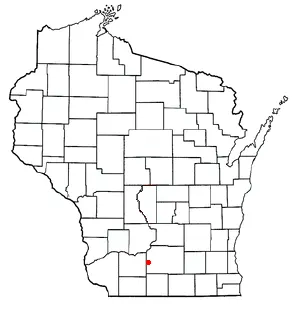
Blue Mounds is a village of about 870 west of Madison, named for the Blue Mounds — the highest point in southern Wisconsin. It is the gateway to Blue Mound State Park and the show caves at Cave of the Mounds, with a quiet rural-residential character.
Home prices in Blue Mounds
Home prices in Blue Mounds vary by neighborhood and property type.
Top places in Blue Mounds
- Blue Mound State Park — observation towers, hiking/biking trails, swimming pool, and camping at southern Wisconsin's highest elevation.
- Cave of the Mounds — National Natural Landmark limestone show cave (just east of the village).
- Military Ridge State Trail access.
- Driftless Area vistas.
Commuting from Blue Mounds
- Approximate drive to downtown Madison: ~35 minutes via US-18/151 (approximate).
Schools in Blue Mounds
Public schools: Mount Horeb Area School District. For enrollment and performance data, see the state report card in Town links below. Confirm school assignment for any address directly with the district.
Blue Mounds FAQs
- What is the housing market like in Blue Mounds, WI?
Home prices in Blue Mounds vary by neighborhood and property type. Price unavailable · Sep 2026 - How is the commute from Blue Mounds, WI?
Approximate drive to downtown Madison: ~35 minutes via US-18/151 (approximate). - Which school district serves Blue Mounds, WI?
Blue Mounds is served by Mount Horeb Area School District. See the state report card in Town links, and confirm school assignment for a specific address with the district.
Town links
Schools
Official town resources. School report cards via the National Center for Education Statistics.